
Translated by Deepl.
In 2009, when I was still enjoying my college life, I was thinking that I would not be able to take a long vacation in the future when I thought about my future working life. I wanted to do something big during my college years, I thought, but nothing in particular came to mind.
However, last year I remembered that a senior student at the same university had cycled around Japan, and I decided to give it a try! I decided to take a year off from college to see the world of Japan as I had never seen it before.
Articles in this category will be compiled on the blog as a way to organize the diaries and photos that I have taken the trouble to record (otherwise, I would never be able to organize them).
Please note that the photos and other information may be very different now, since the organization was done in 2024.
Purpose of Trip
If we’re going to go to all this trouble, let’s have a good motivation! So, we decided to go through with the following motivation.
As a student, I wanted to push the limits without second thoughts.
I will go where I want to go and live the day to the fullest, without worrying about tomorrow’s schedule.
I want to visit places in Japan that I don’t know yet.
Experience trumps knowledge.
If you can be moved by a photograph, the real thing should be even more amazing!
It will definitely help you if you want to live a creative life in the future!
Aim to complete the race as a rite of passage.
I saw a rite of passage like bungee jumping that I had seen on TV a long time ago, and I thought, well, the Japanese don’t have that kind of tradition, so let’s work on this with that in mind!
I decided to do it for the same reason.
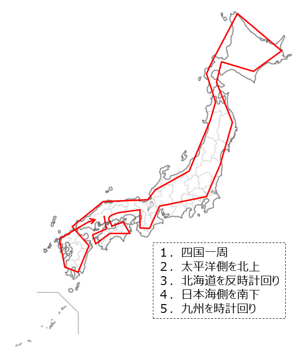
Rough routing
I live in Higashi-Hiroshima City, Hiroshima Prefecture, so I considered what route to take. Considering that I will be traveling around Japan on a bicycle, which I usually use only for commuting to school, and I am almost an amateur, I prioritize Shikoku so that I can head first to Kagawa, where my parents live. After that, I thought about whether to go north or south, and I thought, “Wouldn’t it be cooler if I went to Hokkaido in the summer? We decided to go north. Furthermore, we thought it would be better to go through the Pacific Ocean side before getting used to it because there are many towns there, so we decided to go northward to the Pacific Ocean side and southward to the Sea of Japan side.
No particular preference for the direction of travel (clockwise or counterclockwise) for Shikoku, Hokkaido, Kyushu, etc.
For now, the following route is set up first.
Driving route plan
List of tools
bicycle
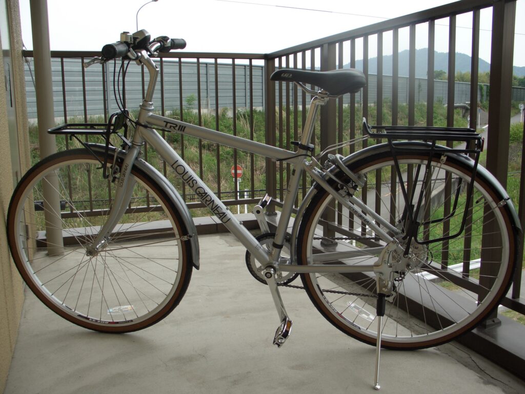
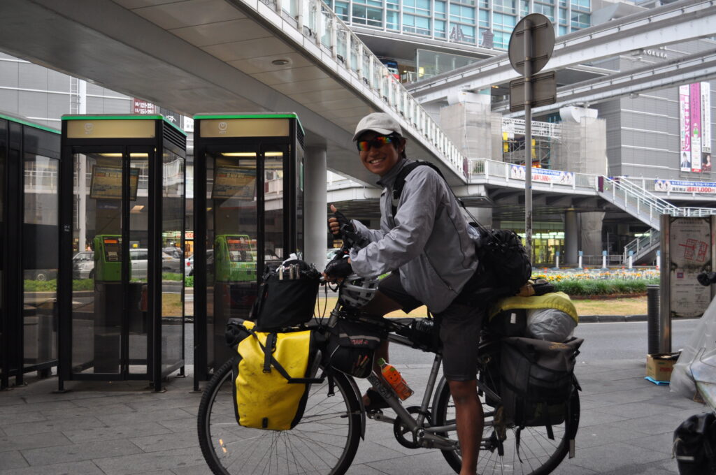
The bike is a Louis Garneau TR3 (LGS-TR3). I am not a fan of Louis Garneau, and this is what I found at a slightly larger bicycle shop in Yokogawa, Hiroshima, that is moderately priced and suitable for traveling.
It has a platform to carry luggage, and the tires are thick, so it feels sturdy. I personally feel safer with thick tires than with thin tires like the sports type because I carry a lot of luggage. The price is about 50,000 yen. I just checked and the description of the model is still on the Louis Garneau website.
https://www.louisgarneausports.com/09bike/09lgs_50-tr_3.html
Bicycle-mounted storage bag
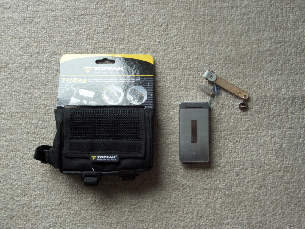
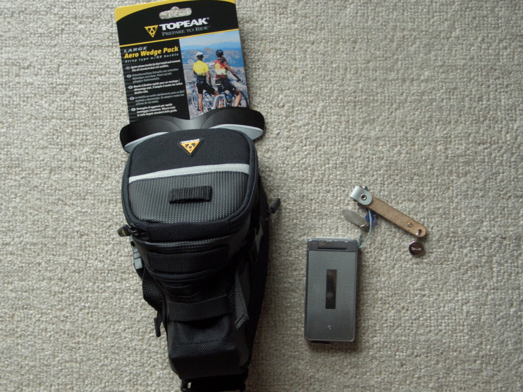
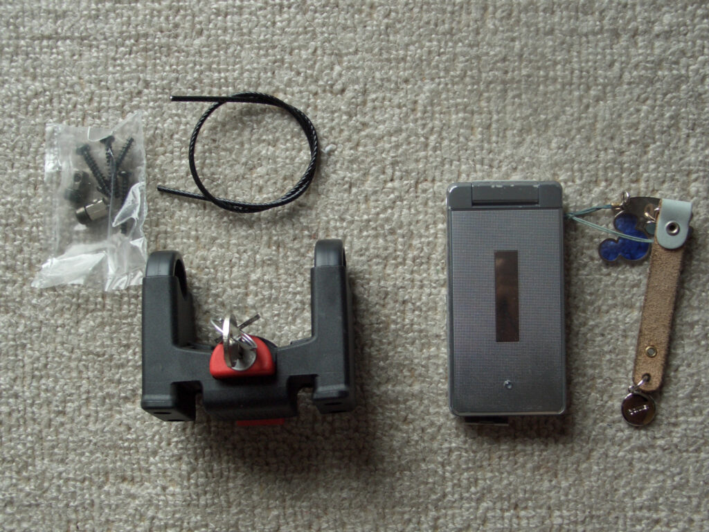
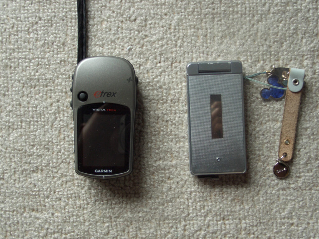
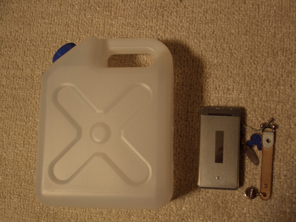
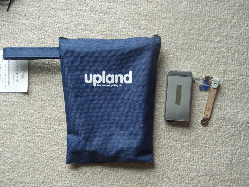
This is equipment to be mounted on a bicycle. I am comparing the size using a cell phone (2009, so it’s a flip phone).
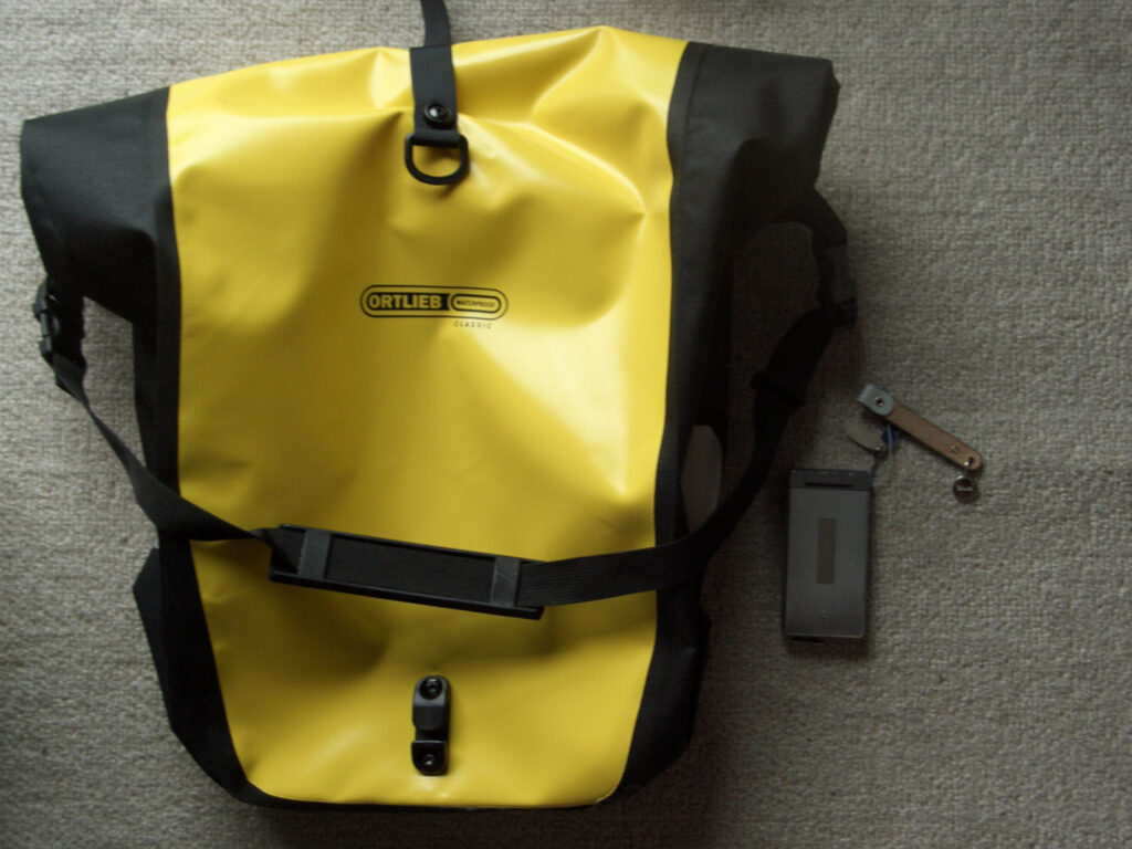
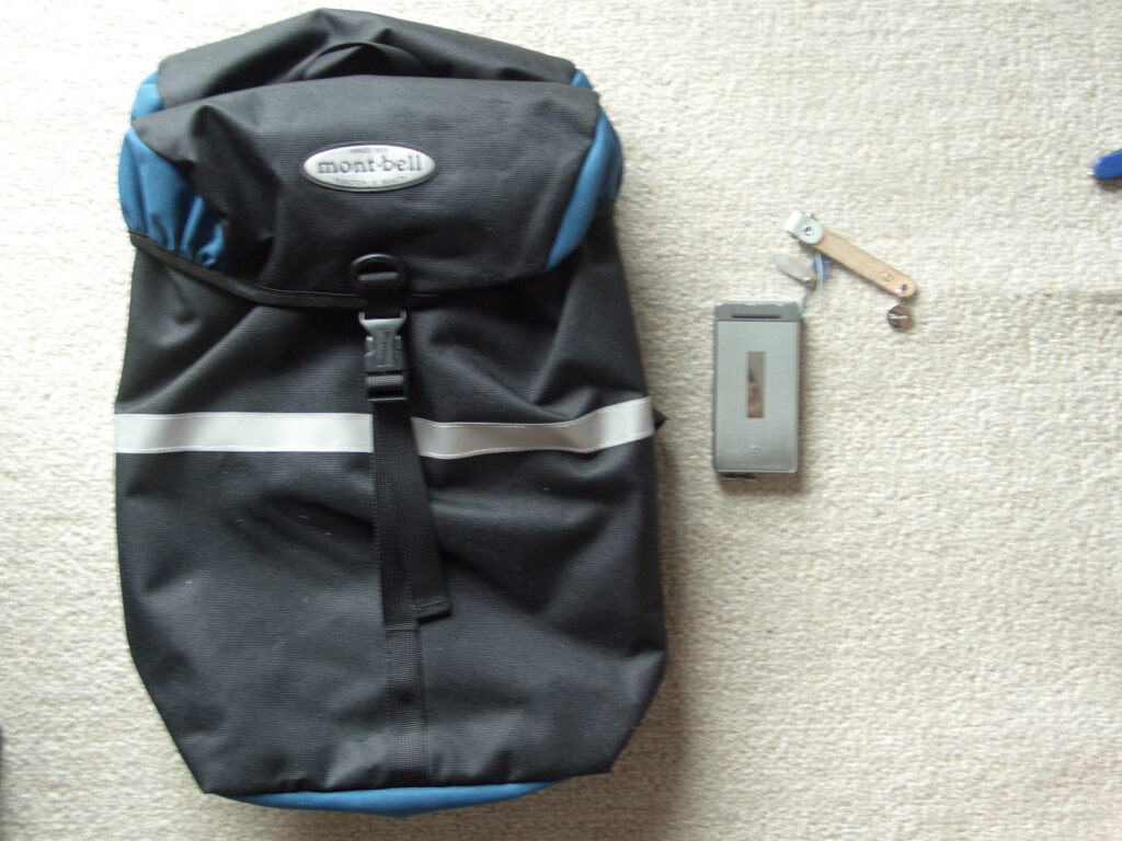
I started with one side bag on each side (mounted on the rear wheel), but as I packed more and more stuff, I realized that the capacity was not enough, so I bought additional bags. The yellow ones are Ortlieb 40L x 2 and the black ones are Montbell 8L x 2.
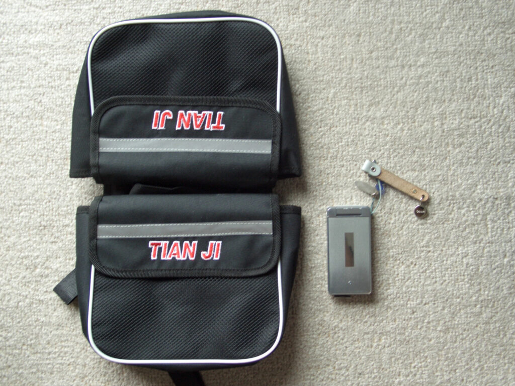
The main items in the bags are side bags (yellow and black), but I’m a bit obsessive about these things. I ended up buying two frame-mounted bags and one under-saddle bag. The frame-mounted bag is for storing small things, but it was especially convenient for my camera. Good scenery can appear at a moment’s notice! The under saddle bag holds my puncture repair tools.
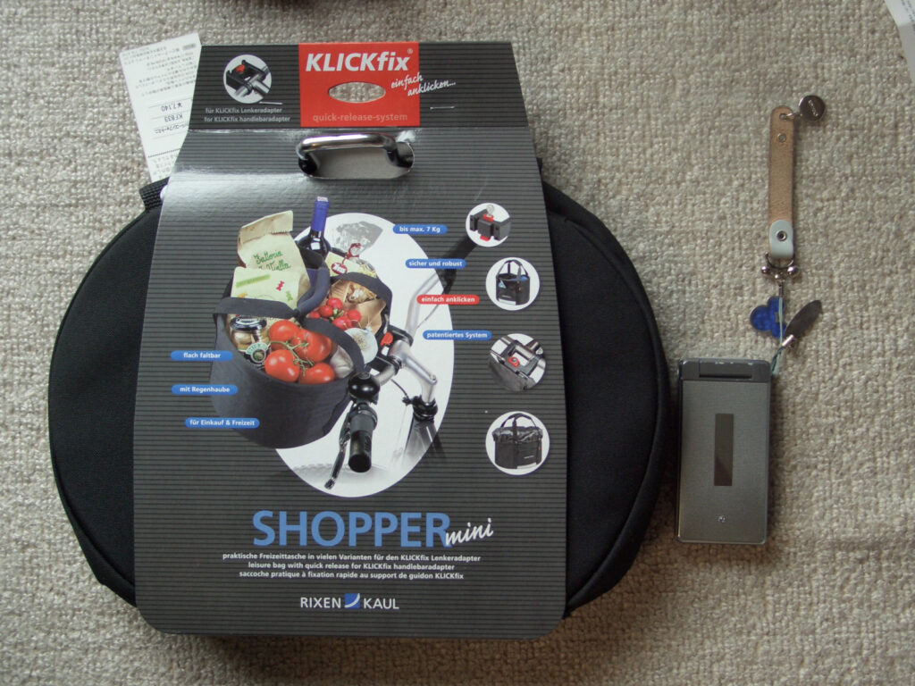
Since I didn’t have a basket, I thought I should put it on, so I bought a front bag that could be retrofitted. However, this bag is not very durable, so only lightweight items could be placed in it. It was difficult to put a large 2L plastic bottle in it because of the weight.
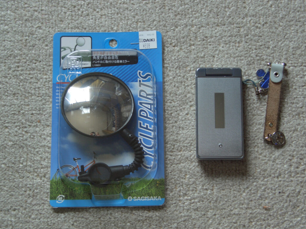
This is a mirror for checking further back. It is quite short. This is because I thought that a long mirror might hit the car, and also because I thought it might not look cool (it’s an unnecessary sense of shame). After all, it was quite useful. Especially at night and in tunnels, the reflection of the car’s lights makes it easy to see who is behind you. Mirrors are still important.
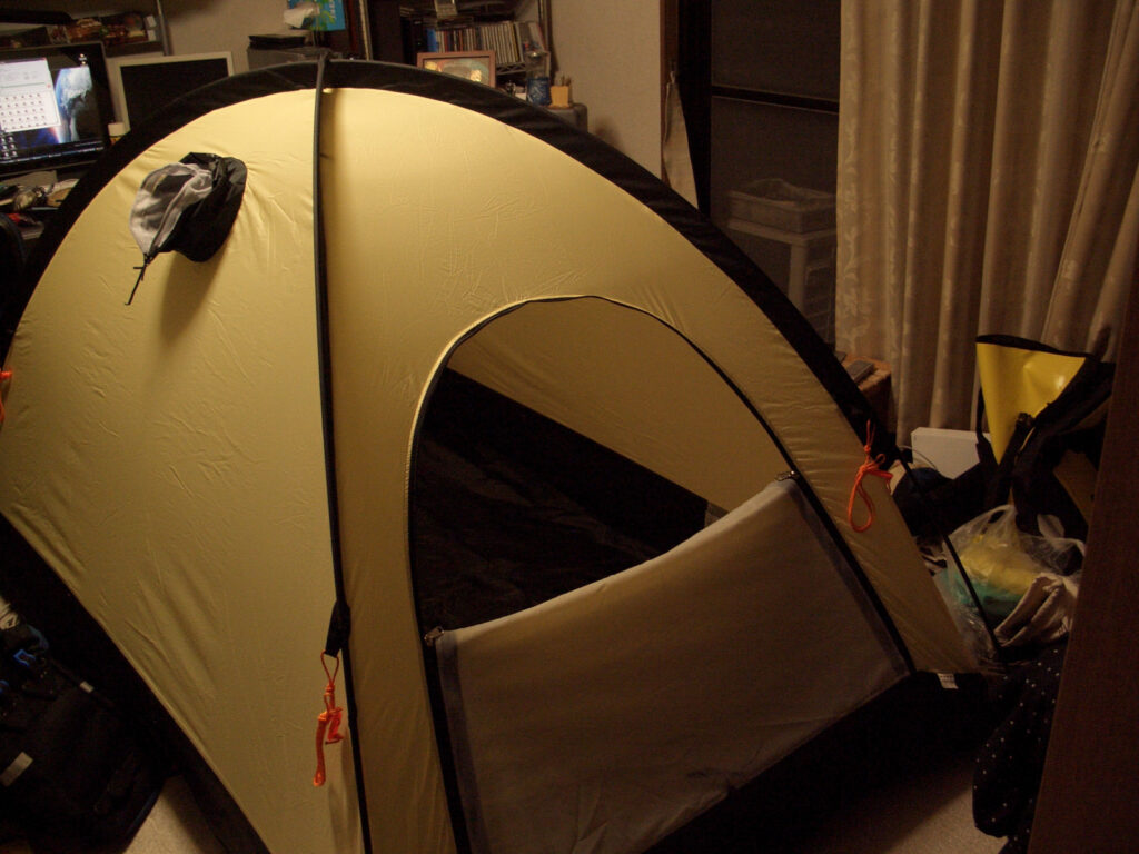
It’s my idea of a modern bicycle! The result is as follows. The following is the result of installing all the equipment.
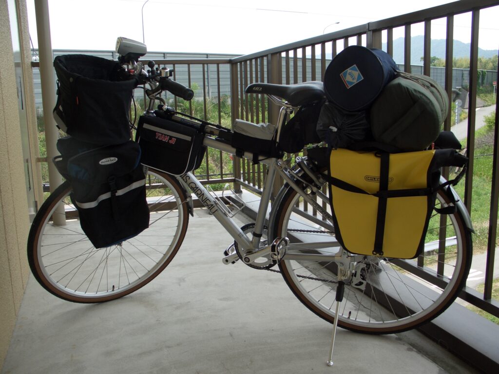
There is a great sense of clutter. Also, there is no sense of unity. However, it’s not good because this kind of preparation is fun. In addition, I added some other things during the trip.
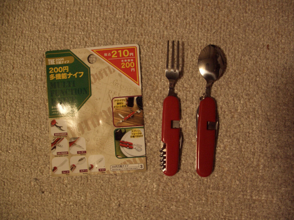
Bicycle Repair Tools
On a bicycle trip, a flat tire = no mobility = death. Therefore, I practiced and prepared the necessary tools to be able to repair punctures only. Patch rubbers and rubber glue are easily available at the 100-yen store. When you get a puncture, you need to put the patch rubber on the puncture site and hit it with a hammer to stick it. I will also bring a spare tube. For this reason, it is important to know the tire size beforehand (and we may purchase additional tires along the way). We do not use a folding scale and can no longer remember why we took it.
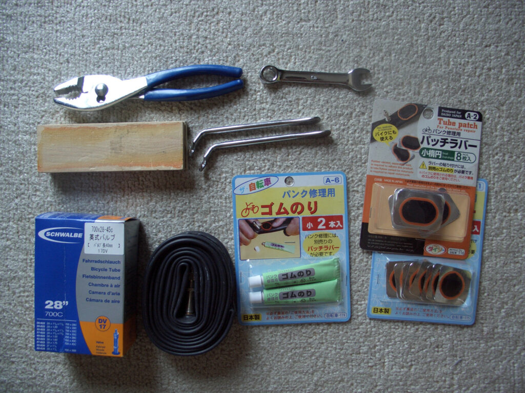
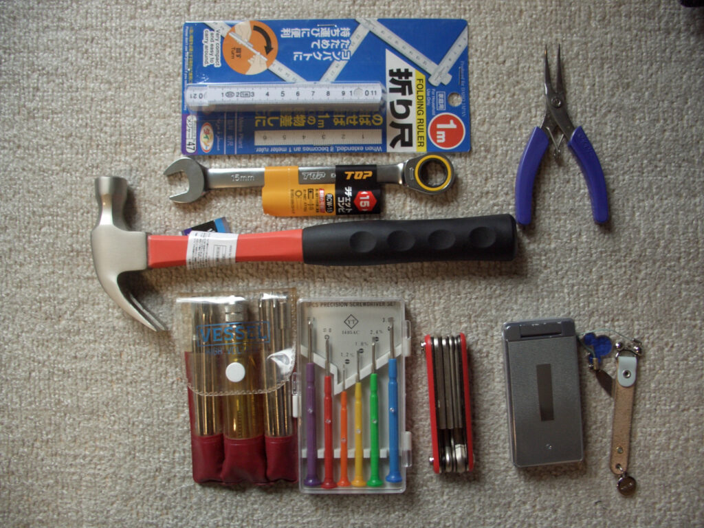
I also brought a repair handbook so that I could make emergency repairs in the event of a breakdown other than a flat tire. As a result, I didn’t use it. Except for punctures, it is best to have your bicycle repaired at a bicycle shop.
Main Bags
A bag to carry valuables, etc., and to be carried under the skin in a sightseeing area is a large waist pouch, lost in the shuffle? A waist bag? I was not sure which bag to take with me.
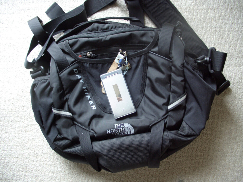
Is the waist bag correct? This…. The selection of the bag was decided after consulting with the bicycle shop. First, he said that we should not use a backpack type because it hurts our shoulders when driving for a long time. A waist pouch is worn around the waist, so it can be worn for long hours of driving, but its capacity is small. So I bought a waist bag like the one in the picture.
When walking, the bag can be held by the shoulder belt on the waist pouch, so you can carry more or less. When driving, the bag is placed on top of a tent or something in the back, so there is not much load on the body.
It was installed as shown above.
Equipment
It is also important to have the right equipment to keep you safe while riding your bicycle. But it is as follows. They are all small items.
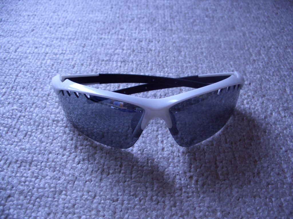
I had bought sunglasses for about 2,000 yen at first, but they broke after a while because I tended to treat them roughly when traveling by bicycle. After that, I used the ones I bought at a hundred-yen store.
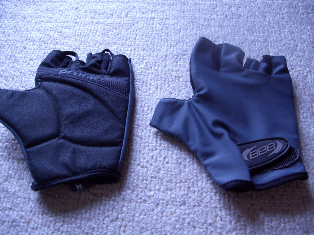
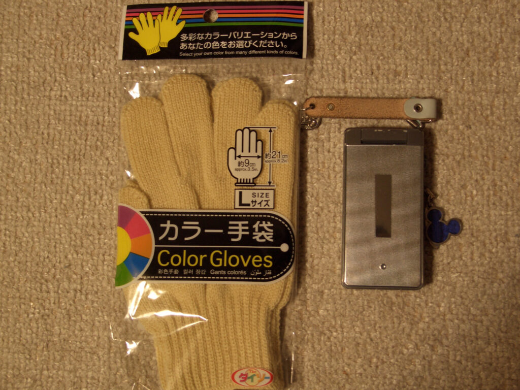
Gloves are actually super important. If you ride a bicycle all the time, the effects of constant pressure on the palms of your hands will cause the tips of your hands to go numb. To prevent this, you need to change the position of your hands frequently and also reduce the pressure. This is where bicycle gloves with thicker palm fabric are important. This will reduce the progression of numbness as much as possible. Changing hand positions is quite difficult because you have to do it consciously…. It would be easier to change the position if the handlebars were of the drop type (the type with a rounded bottom, as seen on road bikes), but my bike was a flat type.
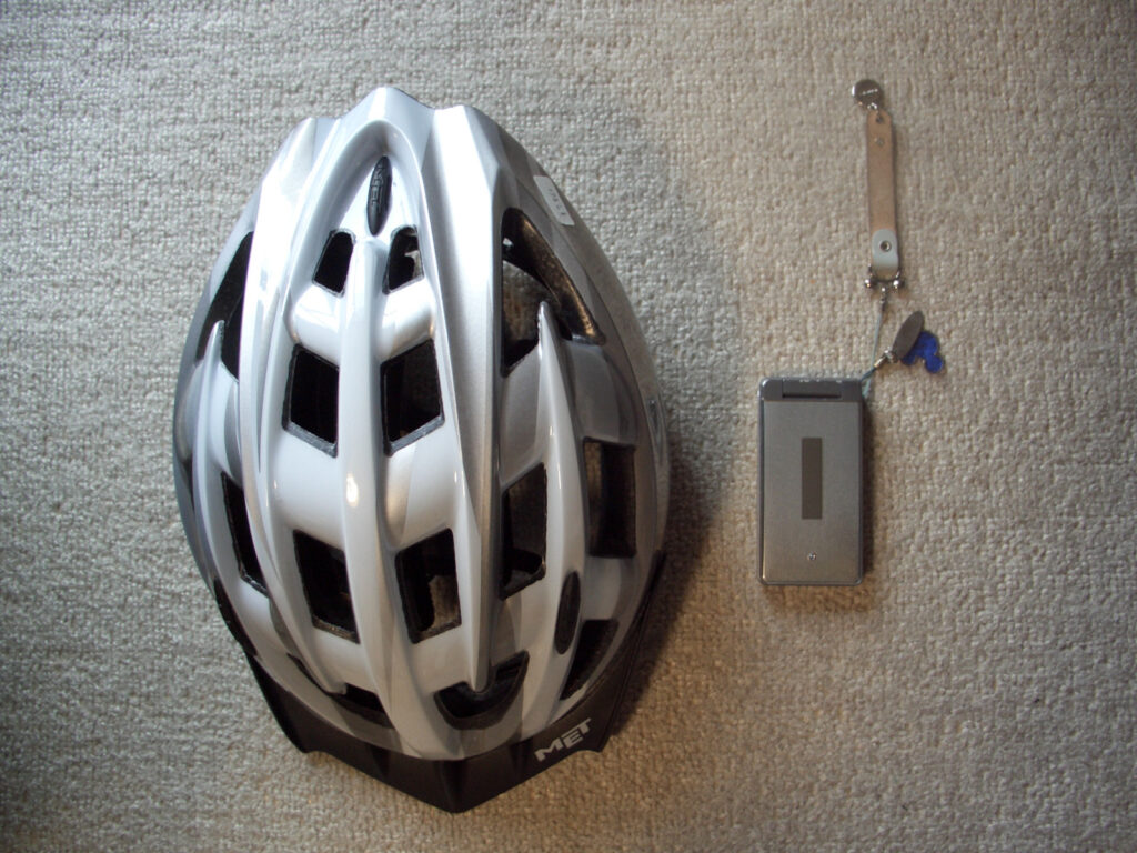
Helmets are important to say the least.
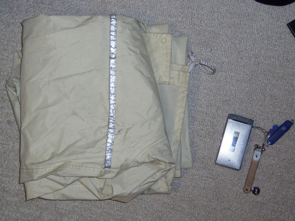
Rain gear is ordinary, commercially available, and not special.
Also, the clothing in detail is basic shorts and sandals. Shorts to lower the resistance at the knees in pedaling the bike. I had a long pants jersey with me, just in case. Sandals are for cooler looking clothes, since it will be hot anyway. Washing socks is a hassle, and I could ride in the rain without worrying. I did not bring sneaker-like shoes because they would be luggage.
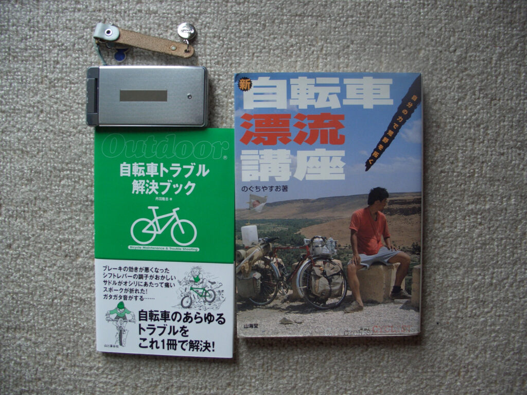
Map
Map! The year was 2009, when the iPhone was just starting to spread, and mobile phones were still in their heyday. And unlike today, smartphones were said to have poor battery life, so I never thought of using a smartphone to view maps.
Then, let’s buy a book map! But a map that covers all of Japan is too big, so I buy a map for each area. I went to the bookstore thinking, “I’m going to buy Mapple, even though it’s big,” but then I saw that they have maps for motorcycles! I bought this one.
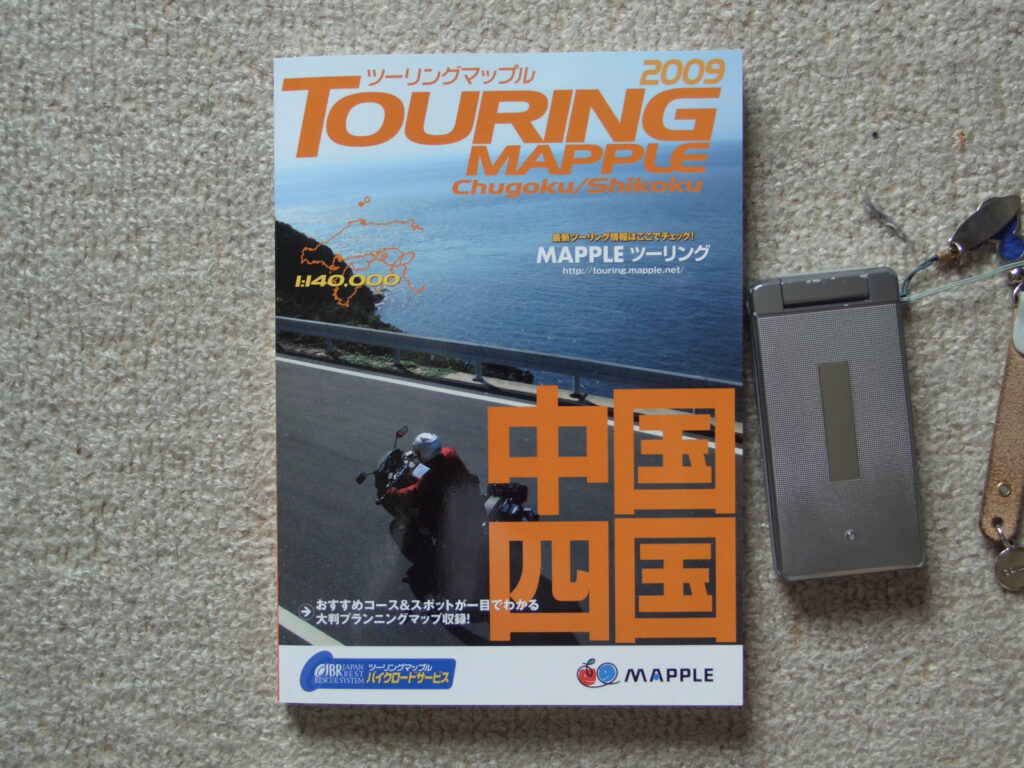
This is Touring Maple, also by Maple. Although Touring Maple is for motorcycles, it has the following features, making it ideal for bicycle trips.
- Compact in size at A5
- Tourist attractions and hot spring spots are highlighted
- Scenic roads are written on it
- Special binding, strong enough to be used continuously folded over
- Some degree of water resistance
- The 2009 edition includes contact information and rates for hot spring resorts, youth hostels, and public accommodations
I especially appreciated the fact that I could continue to use the turnaround, and it was convenient to leave the page for the area I was currently running open and keep it in a clear case so I could always see where I was running.
Tool for living
I am not restricted to using hotels on our bicycle trips, but I am basically in tents. For this reason, I have prepared the following items necessary for a tent stay.
Tent related
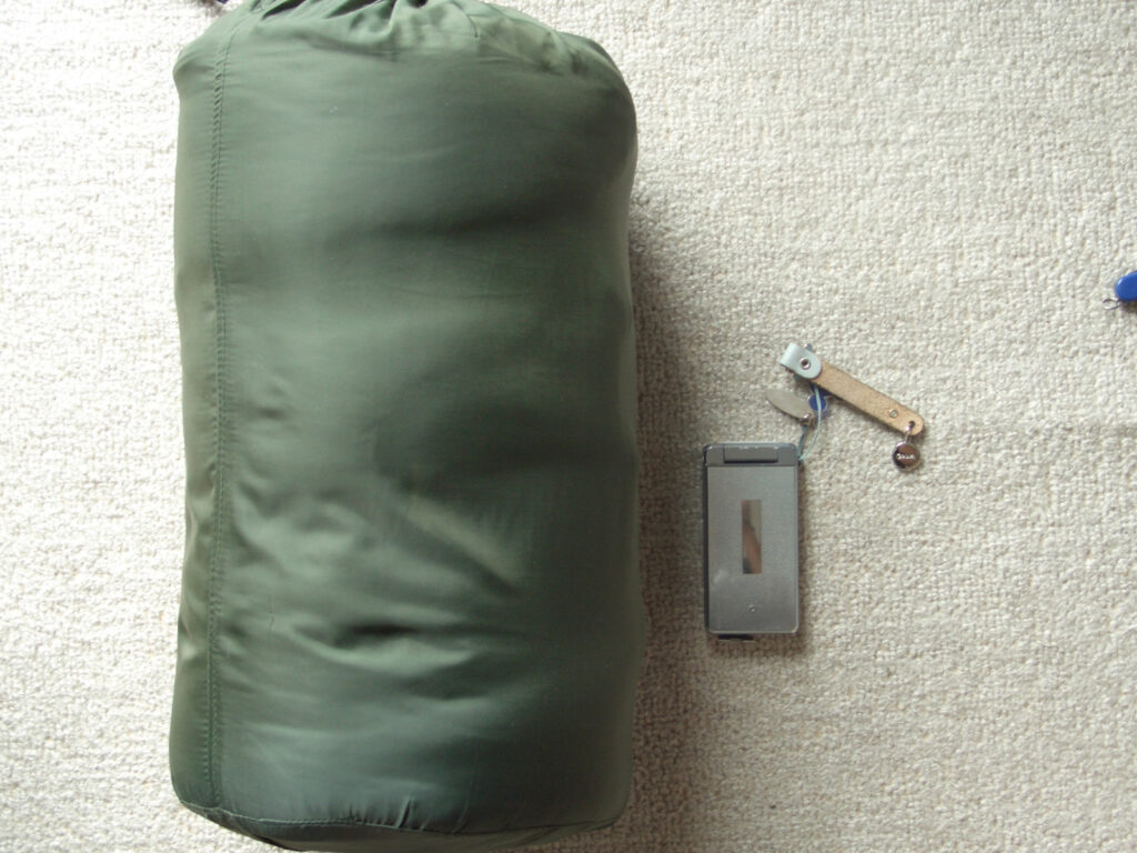
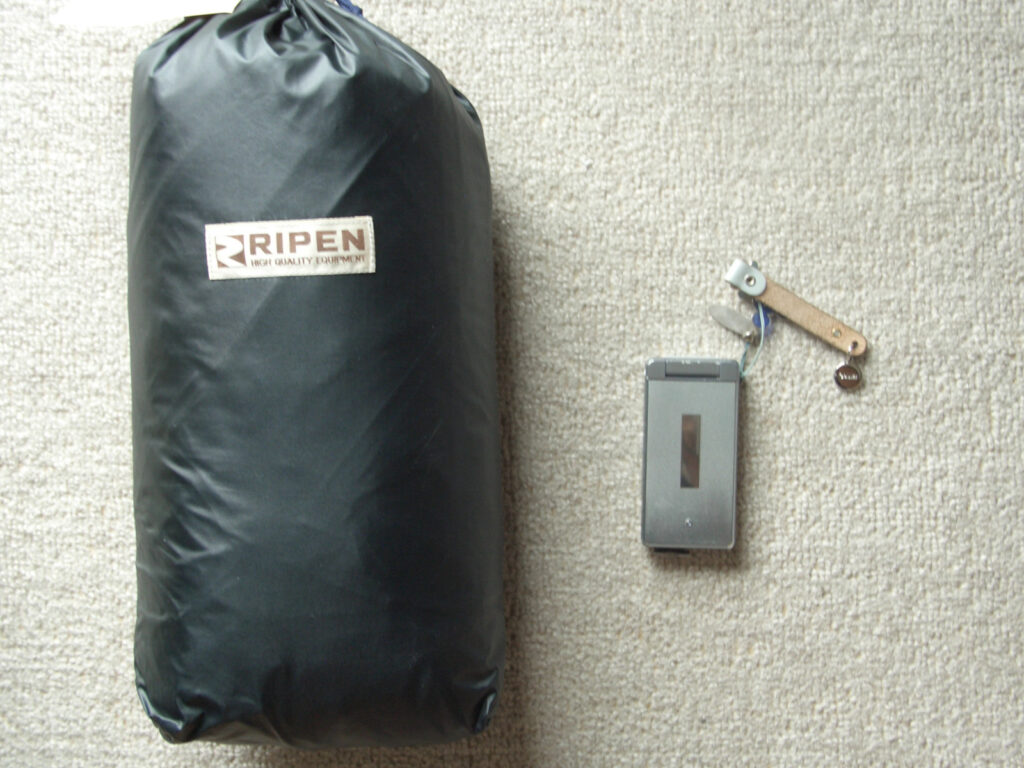
Sleeping bags, tents, and air mats.
The sleeping bag is a simple envelope type. This is not because we were aiming for an envelope type, but just because the one we had at home was an envelope type.
The tent is an Arai Tent Tough Raiz 2, which I bought new. The criteria for choosing this tent were, of course, small size and light weight, but also high water pressure resistance. The Tough Rise 2 weighs about 2 kg and has a water pressure resistance of (I believe) 3000 mm (I have no record of this now). The price was about 30,000 yen, but a tent is a house, so we didn’t skimp on the price. The only regret is that the entrance is only on one side, so there is no ventilation and it is hot in the summer. It would be better if it were designed to allow air to flow through.
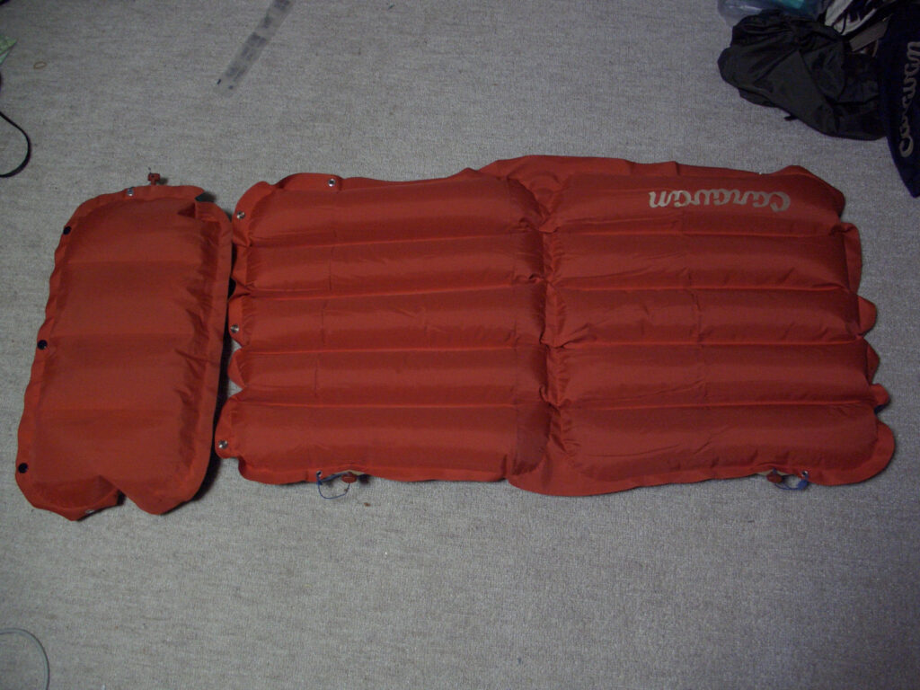
I no longer have a record of the air mats I bought, but they are the kind you inflate yourself with air. The air mat itself was the last thing I needed! but this air bag was not a good idea. First of all, in the picture, the pillow is placed next to the air mat, but when you actually sleep, you put the pillow on top of the air mat (of course). As you can see from the photo, the space for the body is very short. Only the torso is on the air mat, and the legs stick out from the air mat. Furthermore, the mat is slightly narrower and taller, so it is quite unstable. So I used it only the first time and almost didn’t use it. I slept without the air mat until I bought a new air mat in the second half of the year.
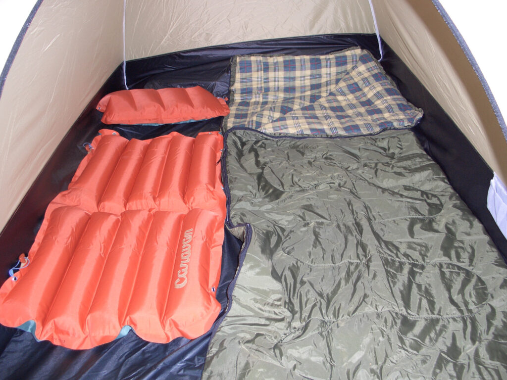
This is what it looks like when the tent is spread out in the room. This tent is cataloged as a two-person tent, but it is a two-person tent, so just one person can sleep in it. It is very tight for two people to sleep in this tent. It is like two people sleeping on a single bed.
Cooking gear
I wanted to do some survival-type things on the trip if I had to, so I brought my cooking gear with me.
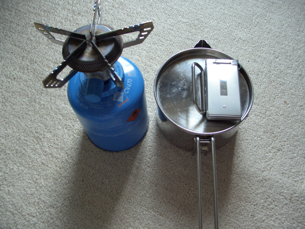
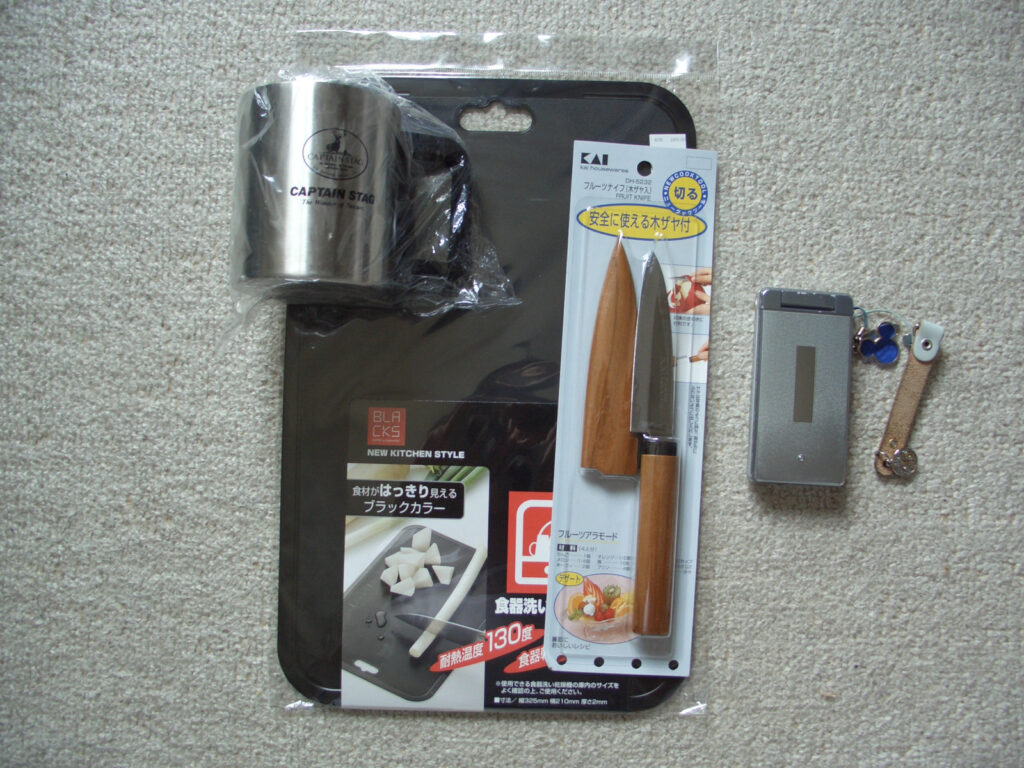
There is no end to the selection of cooking utensils. Therefore, we prioritized tools that can boil water. If you have a small pot, you can boil water, and if you force yourself to use it, you can roast food. Then there are knives, cutting boards, and cups for cutting food. To be honest, I almost never used these items. Especially the cups are not used at all. I drank water directly from plastic bottles on my bicycle trips, so I didn’t use anything fancy like a cup.
First-aid kit
As for first aid gear, it’s hard to say in general what you need. When it was over, I almost didn’t get hurt, and I didn’t catch a cold even though I stayed in a tent in temperatures around 10 degrees Celsius, but that’s just a result of the weather. What I took with me is shown in the following photos.
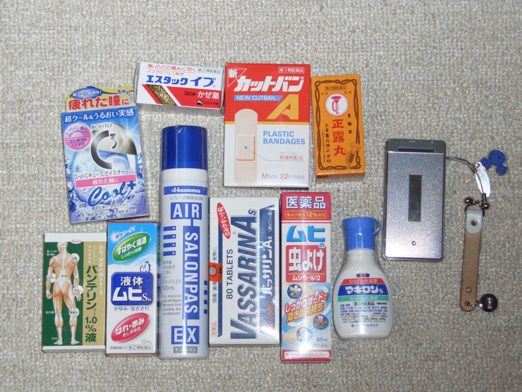
The itching is tolerable, so I guess I don’t need any more MUHI.
Travel Sets
Toothbrushes, soap, and that sort of thing. I prepared the following items because I thought they were necessary to maintain good health.
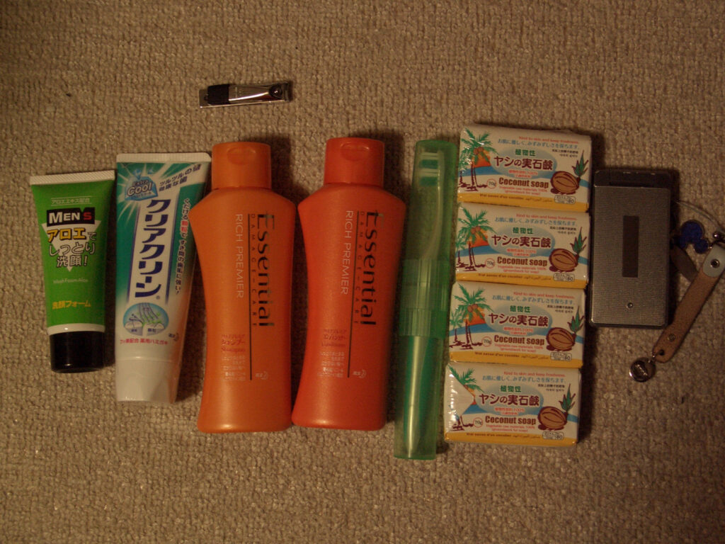
As it turns out, I need this kind of thing, but I don’t use the one pictured now. The reason is that they are just too big. I changed my shampoo and conditioner to a rinse-in shampoo for travel, and I also made my toothpaste much smaller. If I run out, I can buy some on the way. I used all four soaps until the end because they can be used for laundry as well.
Laundry
To stay in a tent, you will need to wash your clothes along the way. Whether you wash your clothes at a laundromat or by hand, you will have to dry them while riding. In this case, we will need a tool to park the laundry on the bicycle. For the time being, we prepared the following items.
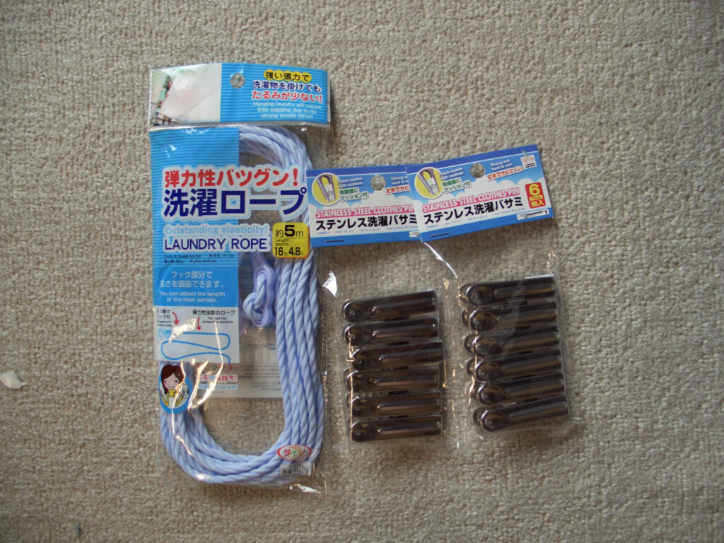
I bought these because I was not thinking straight and thought that a string and clothespins would do the trick. As it turns out, the clothespins were enough. There are many places on the bicycle where you can use clothespins, and you can hang your laundry there. I decided not to use plastic clothespins because I was worried that they would fall apart in the sunlight.
Record tool
It’s a bike trip, and I want to keep the memories. Here is what we prepared for that purpose.
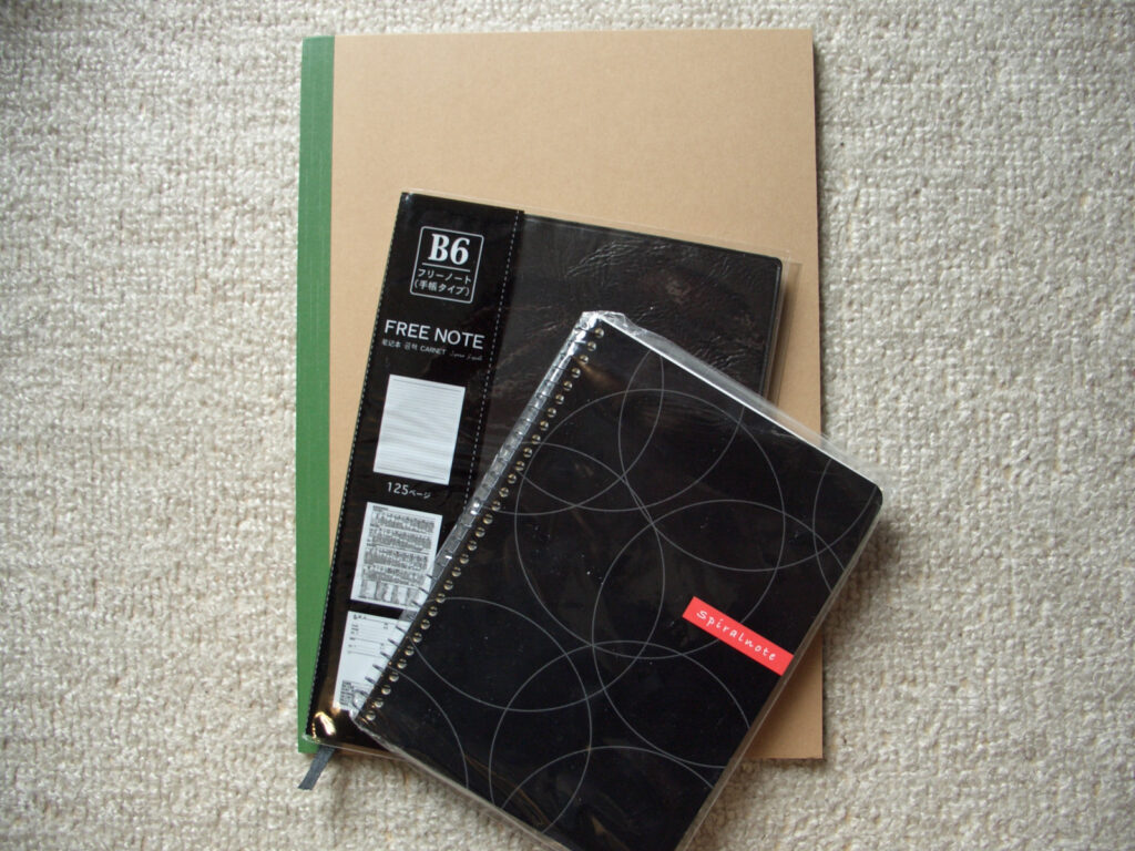
One is a notebook. I replaced it with a sturdier one after about the third day, but this notebook helped me to organize my round-Japan trip. It is a very important tool.
The other is a GPS logger, a GARMIN etrex VISTA HCx. Since I don’t have a smartphone and can’t use Google timeline, I bought a GPS logger to record my own running. I bought this GARMIN etrex VISTA HCx because it had the best battery life of all the ones on the market. Even so, it takes 2 AA batteries for about 20 hours. Main features.
- GPS logs can be stored as long as microSD capacity allows.
- Map data can also be put into the microSD to use it like a driver’s recorder
- Displays not only direction, but also speed, altitude, etc. while driving, making it easy to adjust pace.
- Powered by two AA batteries for about 20 hours. By saving batteries on a daily basis, batteries should be replaced every two days or so.
The battery life is disappointing, but I’m willing to put up with it because I don’t have many other ways to find out my location. I’m not sure if I can use a map alone if I’m in a place I don’t know at all. Also, when I remove the battery, the destination of the GPS logger changes (back to the default), so I had to change the destination to microSD every time.
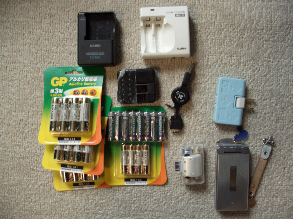
Electronic goods
No matter how much we traveled by bicycle, we brought some electrical equipment with us.
Personal computer
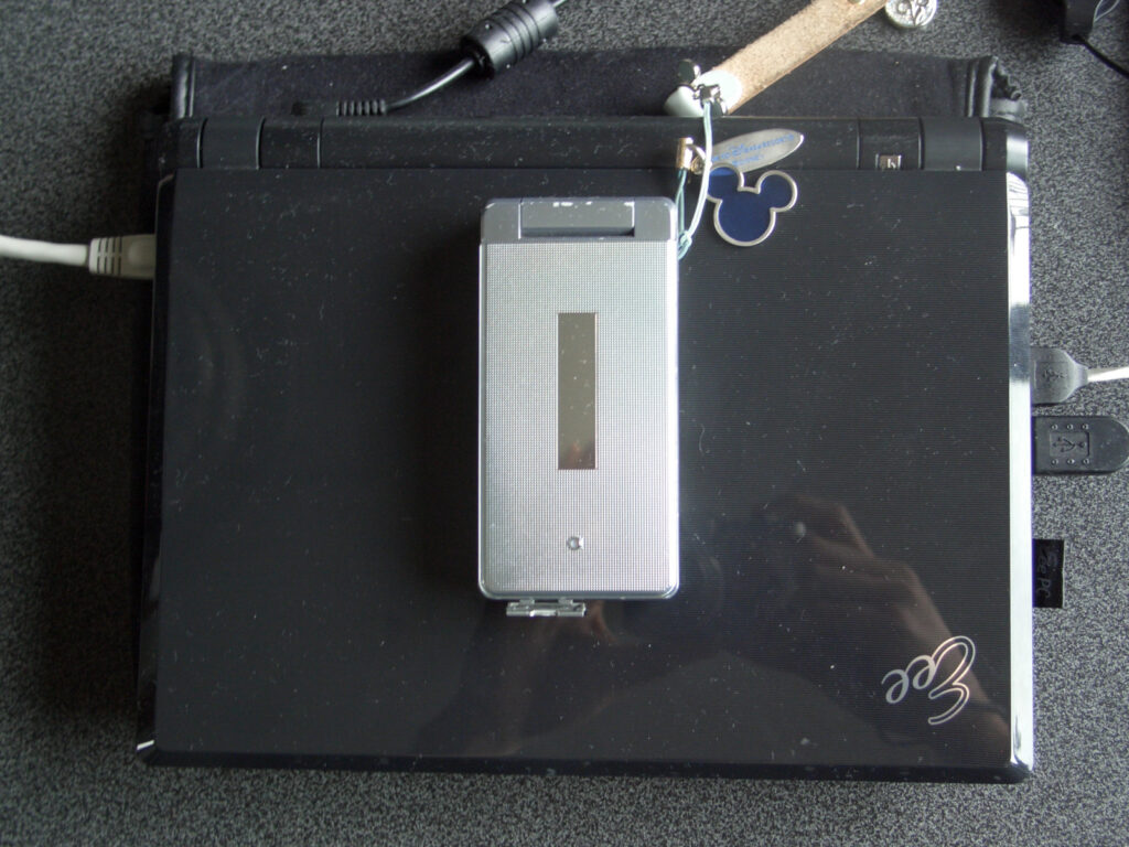
It’s a computer! I took a small computer that Eee was selling. The main purpose was to create documents, check e-mails, and kill time on a bicycle trip, where I was basically free from sunset to bedtime. At that time, there were not many places with free wi-fi, but if you subscribed to Yahoo! Premium for a few hundred yen a month, you could connect at McDonald’s. So I often went to McDonald’s to get wi-fi. Therefore, I visited McDonald’s often. However, not all stores had Wi-fi, so I had a hard time there.
Cellular telephone
As I have put it side by side in the size comparison so far, my cell phone is a flip phone. I use it only for calling and e-mailing. Photos also have the roughness characteristic of a mobile phone, so I only take photos when I want to send a “photo-mail” (a dead language). However, it is reassuring to have a means of communication at hand in case of emergency.
Music player
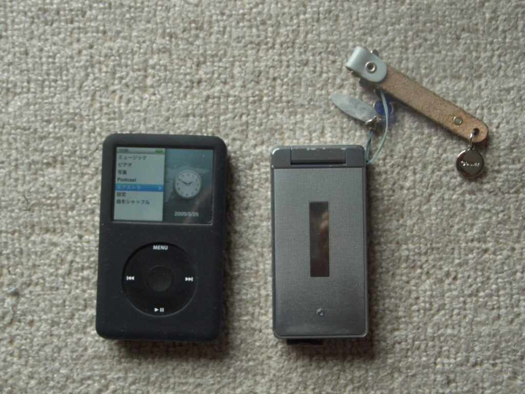
This is another area where technology differs greatly from today in 2024, but I brought a dedicated music player. Specifically, it is an iPod classic, and since it is HDD storage, I could carry a large amount of music (64 GB). I also like that I can operate it without looking at the screen because I can operate it with physical buttons. I listened to it during breaks and such.
Light
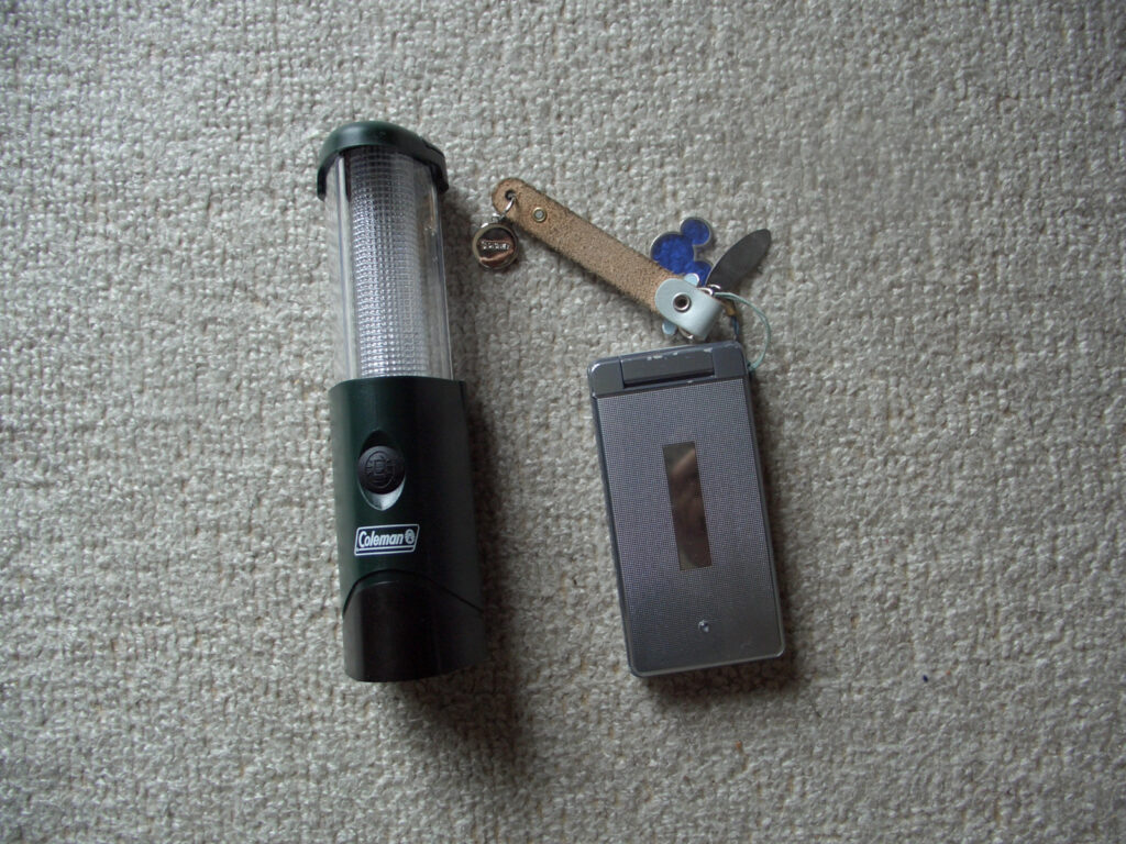
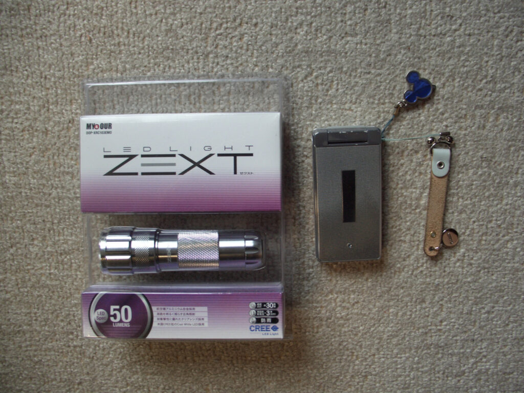
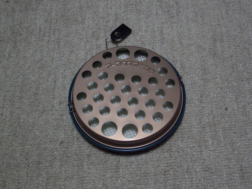
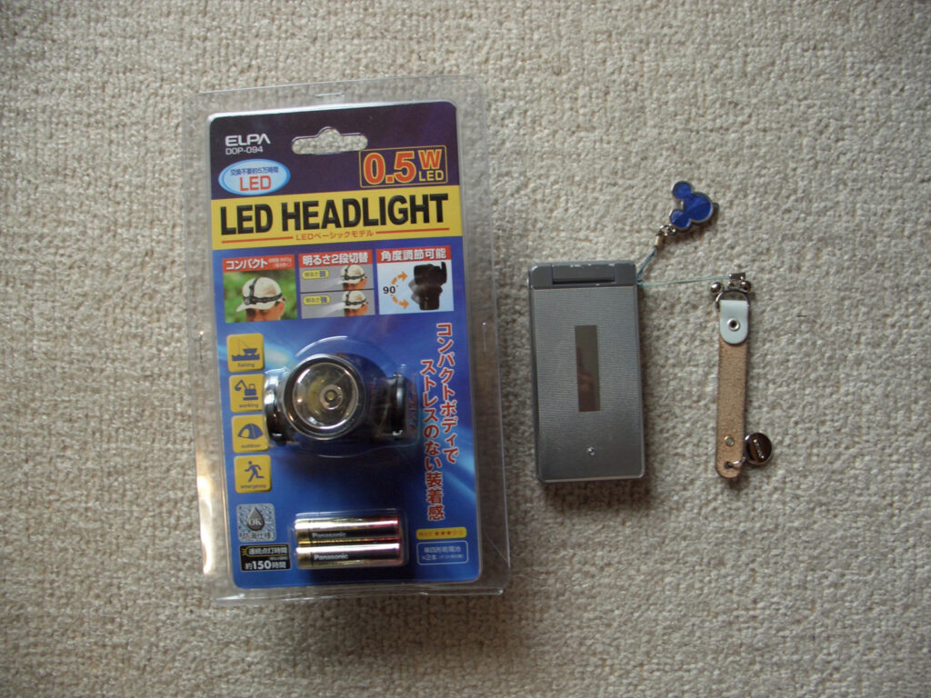
There are two main types of lights. LED lanterns for tents and flashlights. the LED lanterns were nice in that they were small, but they lacked a bit of light and were quite faint when the surroundings were pitch black. We are blessed to have a variety of LED lights nowadays.
Radio
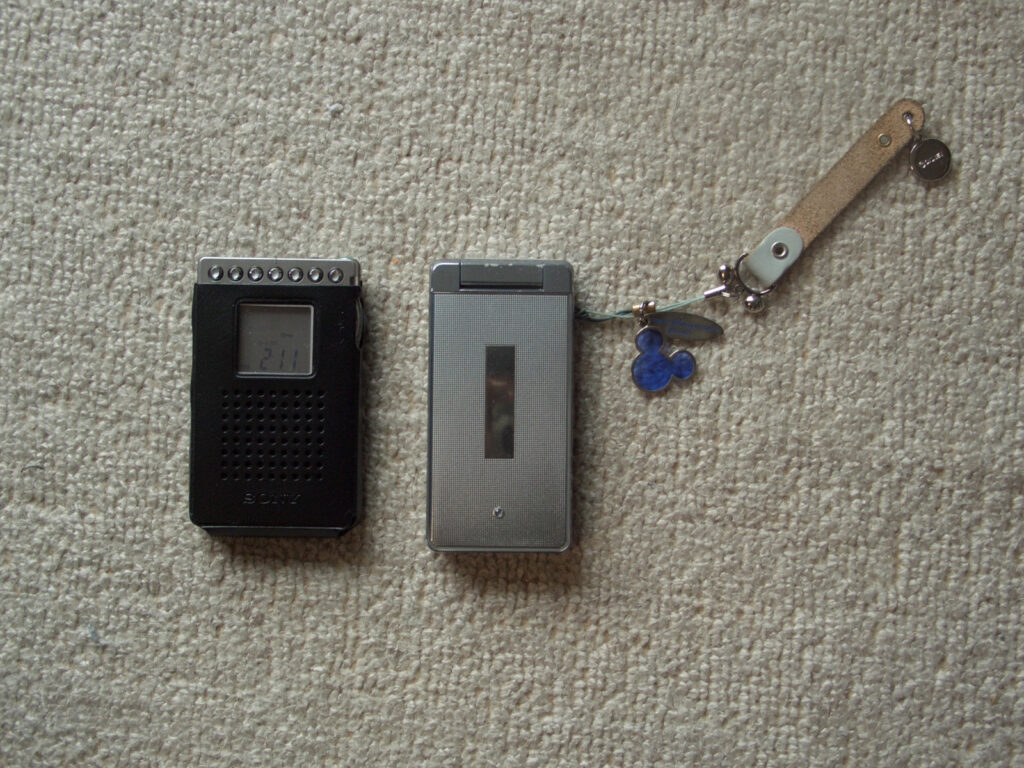
Radio! The only time to listen to it is in the tent, but in these days when you can’t do YouTube on your phone or anything else, I enjoyed the radio a lot. I enjoy doing radio exercises in the morning with it. Also, it’s nice to listen to classical music in the morning. It calms me down!
Things that are no longer needed rather quickly
A series of items that I thought I was bringing with me for good reason, but ended up as luggage.
First of all, mosquito coils. I didn’t use it at all because I am not a sensitive traveler who cares about insects.
Next is the polyethylene tank. I brought a polyethylene tank because I thought water was necessary for life. In the first place, it would be a burden if I put water in the tank.
I think military gloves would be useful and they are not that much luggage, but I did not use them. I have a pair of running gloves, so that is sufficient.
Some people may think that an LED headlamp is also necessary, but I did not use one. However, that is because I have a hand-held flashlight, and some kind of light is always necessary.
The one marked UPLAND is a portable chair. Chairs are everywhere, including on curbs. You can even find them in parks. We didn’t use them at all, they were just luggage.
Location information Automated HP posting
As I have written many times, I did not have a smart phone at that time. Free wi-fi has not been available for about 2024, and to connect to the Internet, I have to find the computer I mentioned earlier in one of the few places with free wi-fi, start up the computer, connect it, and so on, which takes quite a bit of time. It takes a lot of time to start up the computer, especially during the daytime when time is limited.
On the other hand, it was also necessary to let parents, universities, and others see where he was and let them know that he was safe.
If possible, we would like to keep the method simple. But we also want to make it possible for anyone to check. Therefore, we set up a system in advance whereby the date, location, etc. can be automatically uploaded to the homepage when sent from a mobile phone using a specific email template.
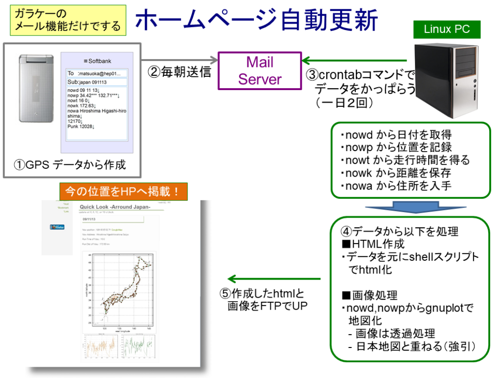
The GPS logger will give us the location of the lodging location, the distance traveled that day, and the time traveled that day, so we obtain that data and the (rough) address of the location obtained from the map.
Send that data with a specific template.
From a Linux PC that is left running all the time, we will access the mail server to retrieve the data created in STEP 1. We will process the data every day, so we will use the crontab command, which runs on a regular schedule, to retrieve the data. In addition, to cope with delays in sending the data in STEP2, we delay the sending of the data a little and retrieve it once more. Note that if the same data is taken one more time from the date data, it should be ignored. However, we cannot do anything more advanced than that, so if you forget to send the data throughout the day, that data will not be linked and will be toothless data.
The acquired data is processed so that it can be posted on the website. I have no knowledge of this area, so I made it very aggressive.
■HTML Creation
The homepage is created using old-fashioned manual HTML. For example, when you want to put location information in numbers on a homepage, you prepare it as a template, because the parts other than numbers are the same every time. Then, I use a Linux shell script to compose “Template + Number + Template” and output HTML data. There may be a better way to do this, but this is the only way I could think of.
■Image Data
We plot the history of the trip on a map, so that you can see where you are on a map of Japan in an overview. The location information is available in latitude and longitude, which is then drawn using Linux’s gnuplot. We then make it into an image with a transparent background. The result is as follows (this is after the project is finished)
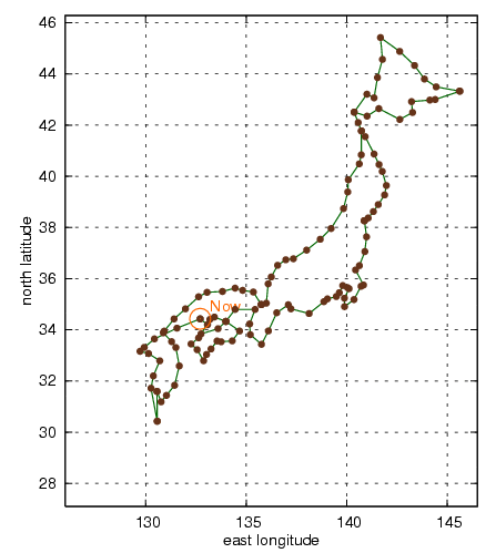
This map was superimposed on a white map of Japan that had already been prepared, and the resulting composite map was prepared for posting on the website. The composite map is shown below.
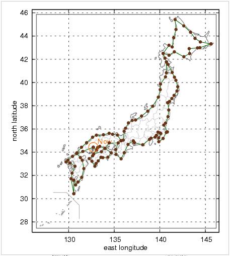
This is now created automatically every day.
Once the HTML and image data are created, all that is left is to upload them to the web server using FTP commands. We have automated this process with crontab so that it can be done automatically. The result is displayed as follows.
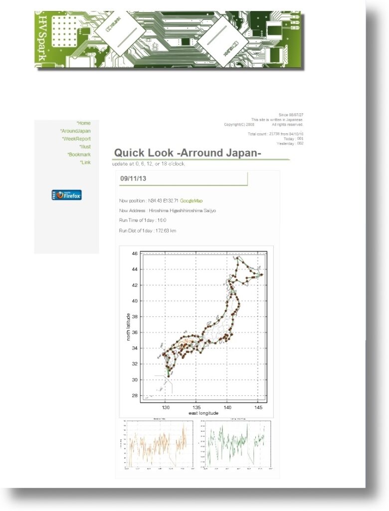
Although GPS loggers can provide fairly accurate values for location information (about +/- 3 m), for safety reasons, we are displaying a reduced order of magnitude.
Anyway, I had to prepare so far to link my current location to my family and university. Nowadays, we can share our location information in real time using various tools, so there is no need to go this far. The world has become so convenient.


Comments